Category Archives: Maps

DAY 29 – 10/13/2012 Acadia National Park

I think I know how I would describe the difference between two of Maine’s parks that we’ve visited – Baxter State Park and Acadia National Park.

Beautiful Acadia

Beautiful Acadia

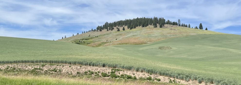
We’ve been to both very recently. They look somewhat different. Baxter has taller mountains and Acadia is by the ocean. I say ‘somewhat different’ because they are, after all, in the same state and not all that far from each other. Less than 200 miles. So the vegetation looks quite similar and both have a lot of rocks.

But, in other ways they are very different. Baxter is a vast, undeveloped wilderness. You can lose yourself in the wild for a long time. (But, of course, the rangers still need to know where you’re going and for how long. If you go missing they will eventually start looking for you. And probably charge you for the expensive search process!)

imagesAcadia, on the other hand, is a great, happy playground for grown ups! It’s quite beautiful, like Baxter, and they try to keep it as wild as possible. But there are hundreds of well-marked and well-used trails to hike.

On the Acadia Carriage Roads

On the Acadia Carriage Roads

At Eagle Lake in Acadia

At Eagle Lake in Acadia

Many, many miles of carriage roads to bike on. Rock climbs to scramble and rock climbs on which to use your advanced skills and ropes.

Lakes, streams, ponds and brooks abound. There’s a sand beach and long, rocky shores to explore.

Giant cruise ship in Frenchman's Bay

Giant cruise ship in Frenchman’s Bay

You can fly over, helicopter over, sail around and drive around all the scenic areas in Acadia.

People take charter buses and even cruise ships to get there. Nothing is really inaccessible. And, it’s so much fun! All the happy vacationers at Acadia are friendly and relaxed – because they’re at the playground!

Another beautiful, rocky trail. See that blue mark? That's the way up and over left!

Another beautiful, rocky trail. See that blue mark? That’s the way up and over left!

Oh, there are friendly people at Baxter also. But, when you come across a person at Baxter, you greet each other almost with surprise. “Oh, look, another person!”

In Acadia, people abound. And it’s lovely. Maine is a place that we travel to quite a bit so we’ll be going back to Acadia, taking some nieces with us!

– Jane

DAYs 10 and 11 – 09/24-25/2012 – East Burke Vermont

Travel, by nature, means we have to leave places to get to new ones.  Leaving family in Stowe was not easy.  Although each person or family we visit, will in some way, sigh some amount of relief as they get to go back to their rhythm and get things done again, or get a little more sleep.  We do get interesting quotes:  I’m jealous, or, I want to do that trip-I can homeschool and come along!

As we contain our “leaving” sadness there always seems a sight or prospect of future fun.

Leaving a high Vermont pass in early morning, blue sky above, but headed into a Valley full of clouds (we promised everyone a “Pretty day was coming” as the fog burned off)

KINGDOM TRAILS, East Burke, VT.

Map highlighted by someone with a little more stamina in her “2 hour ride” than we Southerners

The name seems to come from the Northeast Kingdom.  This cooperative Mountain Bike Area gets rights from private property owners and “snowmobile clubs”.  The map boasts >100 miles, but what I found is Something for Everyone.   Imagine you like to ride your bike in the woods.  What would you look for?  Some would want gentle, smooth trails meandering near a brook throu

This one is smooth and inviting

gh meadows near farms.  Some would want a MountainDew commercial with berms, jumps, gaps, walls, and features abounding from the top of a ski mountain to the wrist-pounding bottom.  While others would seek classic twisty-turny single track leading along topographical features with a few bridges, roots and rocks mixed into interesting spots along the way….

WOW, my two favorites were “Burnham Down” and “Tap and Die”.  I took no pictures of either because all I could do was say WEEE,  WEEEEE,  like the little Geico pig.  (I know, You either love him or hate him).

Suffice to say, once we start working again, we will vacation in the Kingdom Trails.

Perhaps the highlight of each place is the stories and people we meet.  Tom and Berryl are a couple we hope to see again.  Their Ellsworth Tandem has enough technology I’m sure we can talk about as long as we oogled the tramper this morning.  Tim and Maggie were gracious hosts as they let me tag along on trails like “Coronary” and “Coronary Bypass”.  Both plied uphill with the ease you might expect from veterans of this place.  We hope to see them in Maine…

– David

The map of where we may go…

(I’m trying something new. Well, everything we are doing with the blog is new, so newness is relative here.)  We created a map to show some of the places we may visit on our Tramper Voyage. We have a nice paper map, with many little push pins.

It works well at home but this is a blog, so I used Google Maps to help create this lovely USA & Canada map. It might even be somewhat interactive. You know, with the little thingies that let you zoom and move the map.

It’s really not likely that we’ll be able to go to even half of these wonderful places in 6-12 months at our planned slow pace. The map is a good prompter for what we want to do and see. Structure, too, is good.  The “What by when?” question is easier to answer. Although we do already have the answers: What – have fun, be very active, meet nice people, see beautiful things, appreciate life while not on the clock. When – from the day we leave until the money runs out!

Jane